Architects: Want to have your project featured? Showcase your work by uploading projects to Architizer and sign up for our inspirational newsletters.
Global warming has increased volatile weather and is causing sea levels to rise at alarming rates. Combined, these two problems are making coastal regions increasingly vulnerable. Covered in asphalt, concrete and other hard surfaces, cities are already at a disadvantage due to their low porosity. Surface runoff relies heavily on the sewerage system; a very limited amount of water can get away through evaporation.
Unlike more natural or rural areas, where sand and soil can let surface runoff go underground, in cities, water can usually only go down in places where a manhole connected to the city’s sewage system is available. Under such circumstances, water is more likely to accumulate, overwhelming the sewerage system and causing flooding as it takes longer to get back to the underground water system or nearby tributaries. Manhattan is particularly vulnerable.
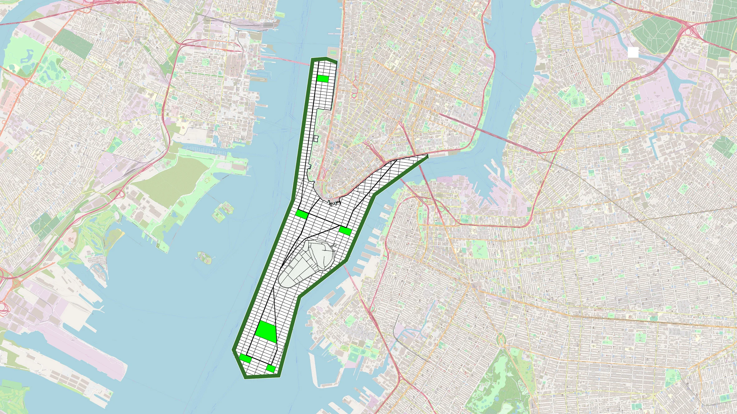
After Hurricane Sandy hit New York City in 2012, the city was left mourning the deaths of 43 people and assessing damage totalling $19 billion. More recently in 2021, Hurricane Ida devastated NYC. Hurricane, surge and flooding are the problems that the city has to deal with urgently. In January, Professor Jason Barr from Rutgers University proposed a divisive solution aimed to combat future flooding: extending Manhattan. The extension scheme is also to tackle the housing issue of the crowded island.
As proposed by Prof. Barr, the extension scheme by the south of the island is about 1,760 acres large. It runs approximately from Holland Tunnel to somewhere around Manhattan Bridge and extend beyond the Statue of Liberty towards the south. The extension seeks to provide about 180,000 housing units for 247,000 people in total. Constructed wetlands will stand between land and water to protect the city behind it from flooding.
Indeed, constructed wetlands have been proved to be environmentally beneficial and mitigate floods. Soil and plants hold the water when it comes and allow it to penetrate the ground while holding them. Compared to an unobstructed urban hard surface where water can run over immediately, constructed wetlands reduce the intensity of peak flow when flooding.
Furthermore, as they are connected to the sewerage, constructed wetlands function as biofilters for treating rainwater/storm runoff and urban grey water. The plants remove nutrients, heavy metals and other pollutants from the water. The filter bed, which normally consists of sand and gravels, also help remove solid contaminants. If well-planned, constructed wetlands can as well be a pleasant part of the urban landscape, adding to the biological diversity in cities.
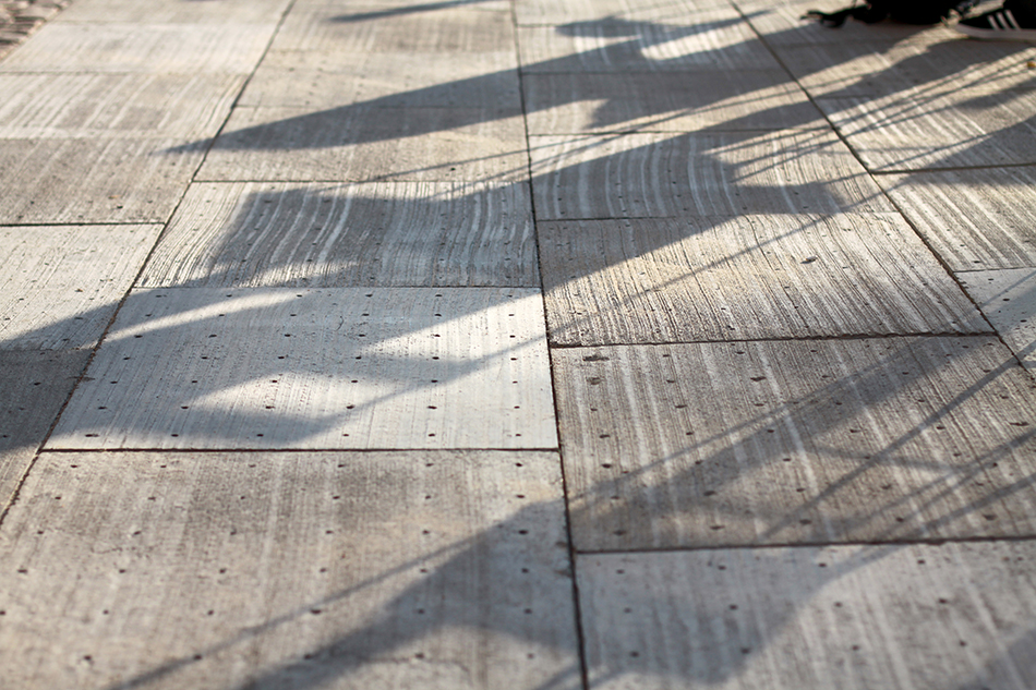
The Climate Tiles installed by Heimdalsgade 22-24, Nørrebro, Copenhagen ©Tredje Natur.
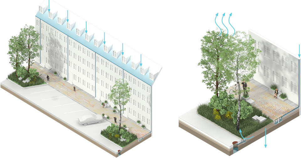
Drawings of the Climate Tiles ©Tredje Natur.
Here comes the question: how large do the constructed marshlands and wetlands need to be on the extension to save Manhattan from damages and losses in future? According to a study after Hurricane Sandy which looked at coastal wetlands’ efficiency in flood/damage reducing, the wetlands covering only 2% of New York State’s land area have saved about $140 million or 0.4% of the state’s total losses.
Looking at the rough plan created by Prof. Barr, it is clear that more careful considerations are needed when planning enough artificial wetlands for protecting the entire Manhattan. Besides, the shown plan is making the East River even narrower, which could reduce its capacity.
There are other urban design strategies to cope with water. The Climate Tile project by Tredje Natur is reintroducing the hydrologic cycle to the city of Copenhagen. The visible part of the project is pavement tiles with small wholes on them that allow water to infiltrate into the ground and down to the sewerage. It is mimicking the natural process where surface runoff joins the groundwater through infiltrating the soil.
An invisible component of the project lies beneath the tiles, where the main part of the artificial water system functions. The rainwater collected from rooftops and the street level gathers through pipes. Connected to the soil under urban green areas, the water collected is then supplied to plants. The excess goes into the city’s drainage system after part of the water and nutrients are consumed by plants. This scheme can let water into the ground faster rather than completely relying on storm drains. By feeding water to plants first, it also controls the amount of water going into the main sewerage.
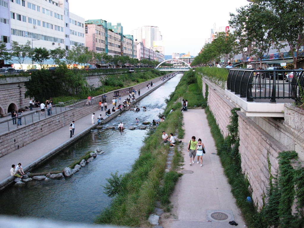
The restored Cheonggyecheon River, photo by Isageum on Flickr, accessed from Wikimedia Commons.
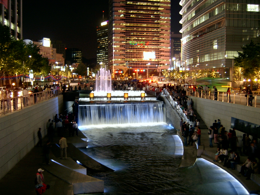
The restored Cheonggyecheon River, photo provided by Cheonggyecheon official website.
While the Climate Tile requires careful corporations with the existing drainage system, the Cheonggyecheon River restoration project in Seoul, South Korea, took the “radical” route in giving the river back to the hydrologic system. The Cheonggyecheon River flowed underground for about 50 years before once again seeing the light of day in 2005. The river was nearly dry when the road and highway that run above it have been removed. Continuing for over three miles, the river banks became a linear urban green space as well as flood plains to hold the river’s overflow during heavy rains.
Flood plains for overflowing are not any kind of modern invention but the most natural way to deal with seasonal flooding. As we harden the land to build more towers, we are also sacrificing the capacity of water bodies around cities. Meanwhile, the sea level keeps rising, pushing our water system even closer to its limit. Cities then become vulnerable when regular or unexpected heavy precipitation comes, leaving tragedies behind. Keeping a respectful distance between the built environment and nature is our way out from the climatic crisis, rather than continuing invading.
Architects: Want to have your project featured? Showcase your work by uploading projects to Architizer and sign up for our inspirational newsletters.
