From surveying construction sites safely and more frequently to providing fly-throughs for investors, clients and the general public, drones have been instrumental in advancing architecture and construction — and leading the way in drone technology is DJI. That’s why for 2017, Architizer bestowed the company with the coveted A+Award for Product of the Year at a gala celebration in New York City last week.
With more than 2,000 engineers who have a proven track record of innovating in drone technology, DJI has been staying at the forefront not only by utilizing its in-house talent, but also by listening to various professionals to determine the ways in which drones can enhance lives and industries. These have ranged from alerting pilots of nearby aircraft and monitoring erosion or illegal dumping to using thermal imaging cameras to find missing persons and aiding emergency rescue teams while keeping them out of harm’s way. Closer to home, DJI’s products have been used by Arup to survey a 131-acre industrial site for a redevelopment proposal and by Skylab to map 1,000 kilometers of highways in Mexico.

We spoke with Michael Perry, DJI’s director of strategic partnerships, to learn more about the company’s thoughts on their products being used in our industry and what’s new at DJI.
Sheila Kim: How does it feel to win the A+Award?
Michael Perry: This was a great surprise for us at DJI. We’re focused on trying to make transformative technology that can make aerial imaging accessible to everyone, so it’s gratifying to learn how important our advances have been for architecture, engineering and construction.

What are your thoughts on how drones have impacted architecture and construction in recent years?
We are continually amazed at all the great uses people find for our products, and professional users are just beginning to understand what they can do with this technology. For example, it’s relatively easy to understand how a 20-minute drone flight can replace a full day or two of surveying to capture site conditions. But what happens when managers realize they can perform that flight every morning, then adjust work schedules and material deliveries each day based on a much more accurate stream of information? The people who use drones every day are beginning to realize all the efficiencies that drones make possible.

How do professionals collaborate with DJI?
DJI’s products have become the center of an entire ecosystem of hardware and software solutions. Companies such as Pix4D, Skycatch and DroneDeploy provide apps and cloud-based processing that allow anyone to begin capturing aerial data on their sites and generating useful information. For more intensive applications, firms like Measure and DroneBase provide a range of flight services to customers without their own drone equipment.

Tell us about DJI’s recently released Phantom 4 Advanced and how it can help architects.
MP: The Phantom 4 Advanced puts a better camera into our industry-leading Phantom 4 platform at a price point that makes it affordable for a wide range of users. Its 20-megapixel 4K camera provides resolution and color fidelity simply unmatched by the sensors in other drone platforms, and its innovative mechanical shutter ensures images will be free of “rolling shutter” flaws even when capturing imagery in motion. The better our products capture reality, the better architects and other industry professionals can turn their designs into reality.

Any other recent updates?
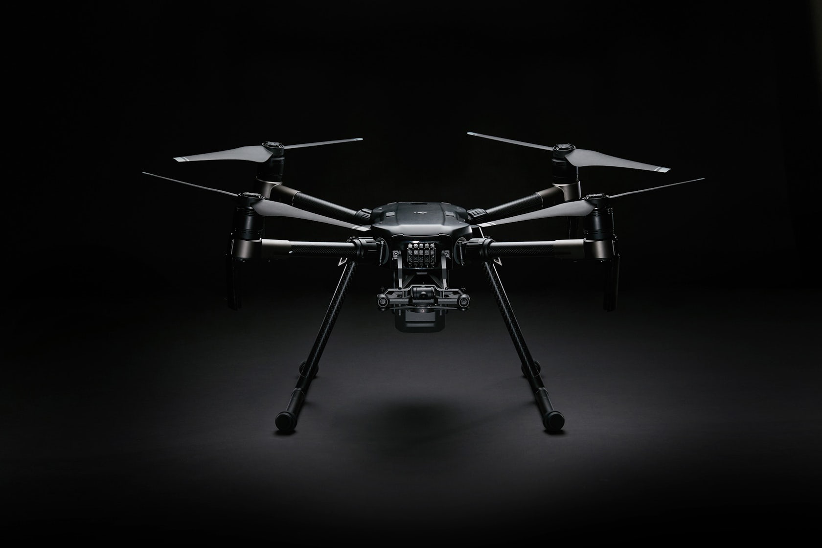
We introduced our first series of drones purpose-built for enterprise use, the M200 platform. It is designed for professional uses from construction and surveying to inspections and rescue work, with a host of features that no other drone platform can touch. It features weather-resistant construction, the opportunity to mount an upward-facing camera or side-by-side cameras facing down, the ability to upgrade to centimeter-level navigational precision without electromagnetic interference and a robust expansion capability for mission-specific software as well as specialized sensor payloads.

What’s in the pipeline?
We never talk about upcoming products until they’re ready to amaze our customers, but it’s safe to say we’re intensely focused on responding to feedback from professional users and meeting the challenges they face. Drones have moved rapidly from being a curiosity to a necessity in many industries, and in many cases, rapid adoption of drone platforms requires new work-flows, new data management systems and new approaches to project management. As our customers demand more than just incredible flying platforms, we intend to be leaders in building the entire ecosystem that they’ll be able to rely on.
What do you envision drones will do for the architecture and construction industries in the future?
DJI is focused on building the best possible hardware for professional users, and we are seeding a profusion of software solutions on our platforms, as well. As we get feedback from architects, designers, engineers and construction managers, we use it to further refine our development efforts and help them satisfy their needs. The professionals who use our products are the ones who can best define what they need from an aerial platform, and we want our technology to be as transparent as possible for them so they can focus on getting the data they need in the format easiest for them to use.